Schiehallion
Our plans for the weekend were for a camping trip to Jura, a traverse of Beinn Eighe and ascent of Schiehallion. Only the last survived a combination of rail strikes, covid infections and inclement weather.
Schiehallion is one of the most easily identified and popular mountains in Central Perthshire with great views - though not this weekend. The east side of the mountain, from which most ascents are made, is now owned by the John Muir Trust. The mountain also has an interesting scientific history, being the location for an eighteenth century experiment to calculate the mass of the earth. Charles Hutton a mathematician on the experiment had the task of measuring the volume of the mountain and developed the idea of contour lines to give an instant view of the terrain. We have used them ever since.

Cerian writes:
We set off from Inverness in glorious sunshine. So despite the forecast, we were optimistic of a good day. Upon arriving at the Braes of Foss car park, we were surprised to be greeted by the friendly 'visitor stewards' who showed us where to park and where the walk started.
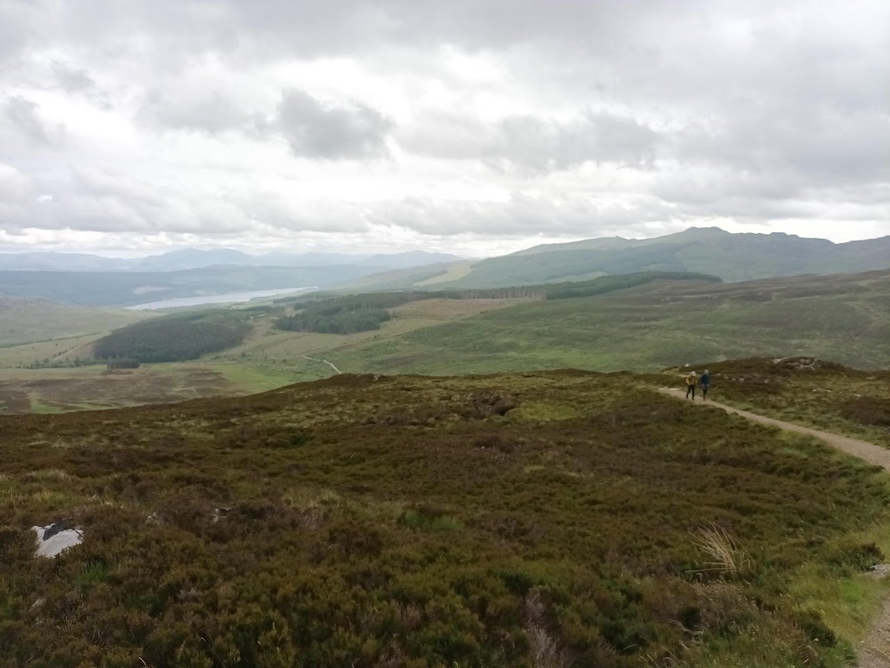
The clag on Schiehallion did nothing to dampen our enthusiasm so we set off up the good path and even managed a few pics as Loch Tummel came into view. Shortly after reaching the 750m contour the clag started to envelop us. To the west some ominous dark clouds were appearing so on with the waterproofs we went.
There were a surprising number of people from all walks of life on the hill despite the weather. The proximity to the central belt certainly makes Shiehallion popular and its good to see so many people getting out. The path was still good and spirits were high as we plodded on.
Soon the forecast winds arrived as we followed the cairns up the ridge. We decided to skip our usual elevenses in favour of getting shelter up by the summit. The winds and clag made the summit boulders a bit tricky but soon enough we made the top and hunkered down for a well earned lunch. As we started to descend the winds really started to pick up. This made the infamous Shiehallion boulder field quite a challenge with us having to stop and brace every few steps.
Despite the deteriorating weather it was surprising to see yet more people ascending. Some in nothing more than hoodies, jeans and trainers. At one particular point we were surprised to hear shrieking behind us. We turned to see a lady being badly buffeted around so we checked if she needed help. We were amazed to hear her say she was shrieking in delight. Each to their own!
Soon enough we broke back through the clag and enjoyed the final descent back to the car. All in all we were longer coming down than ascending thanks to the winds. It was good to test ourselves against the elements though and a good time was had by all.
Taking part: May, Karolina, Michael, Tim and Cerian
Words: Cerian
Photos: Cerian