Useful links and resources
Mountaineering Scotland
IMC is a club member of Mountaineering Scotland - the representative organisation for hill walkers, climbers, mountaineers and ski-tourers in Scotland.
This gives IMC members access to summer and winter mountain skills courses, advice and information, access to mountain huts, retail and accommodation discounts and European huts reciprocal rights card.
Scottish Avalanche Information Service
SAIS provides avalanche assessment reports for six major mountain areas in Scotland. These, together with the avalanche forecasters blogs, provide really valuable information on snow conditions and hazards.
The Be Avalanche Aware toolkit -http://beaware.sais.gov.uk and App (IOS and Android) give you really good tools for planning your winter trip and for keeping safe on winter hills.
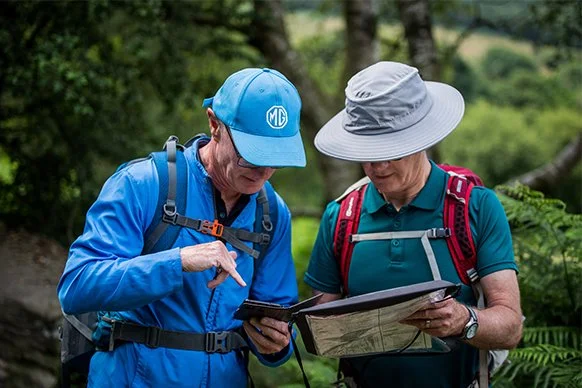
OS Map Reading guides
Ordnance Survey have released some handy guides for brushing up your navigation skills. When you want basic or advanced skills, here is a good starting point. And even better, they are free.
https://getoutside.ordnancesurvey.co.uk/guides/map-reading-week/
Mountain Weather Information Service
Mountain Weather Information Service provides three day weather forecasts for five mountain and hill areas in Scotland and five in England and Wales. It also provides a Planning Outlook video for a week or ten days ahead.

Met Office
The Met Office provides a range of forecast for the UK. Of particular interest to hill goers is the mountain forecast for four Scottish regions and six forecasts covering the hills and mountains of Northern Ireland, England and Wales. https://www.metoffice.gov.uk/weather/specialist-forecasts/mountain
From each regional forecast you can also drill down into summit specific forecasts.
Heading For the Scottish Hills
Heading for the Scottish Hills helps you find out where stalking is taking place during the stag stalking season (from 1st July to 20th October) to help you plan your route which minimises the change of disturbing stalking in line with the Scottish Outdoor Access Code.

Walkhighlands
Walkhighlands has over 2000 descriptions and maps of walking routes mainly in the Scottish mountains and hills together with walk reports from its members. The site gives access to OS maps and you can record the summits you have bagged.
FATMAP
Fatmap is “an outdoor adventure platform” for both web and mobile (IOS and Android). It provides free access to 3D maps and adventure guides across many countries and mountain ranges for hiking, biking, skiing and climbing.
The 3D mapping has overlays including slope gradient, aspect, avalanche risk and is is very helpful for route planning and navigation on the ground.
Paid membership opens up offline map downloads, topo maps (including OS maps for the UK) and other goodies.